
Route Info
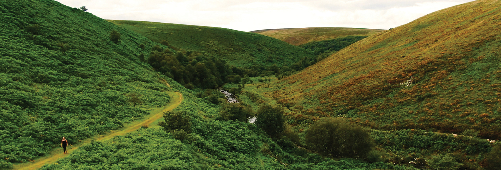
The walk follows the valley of a small river known as Badgworthy Water, through fields, woodland and eventually moorland to the deserted medieval village of Badgworthy. This area is known as “Doone Country” after the novel Lorna Doone which was set in this part of Exmoor. This is the longest of our Explorer walks, but the views and sense of tranquillity when you get to Badgworthy are worth the effort. Purchase a water and tear resistant route guide online or from an Exmoor National Park Centre.
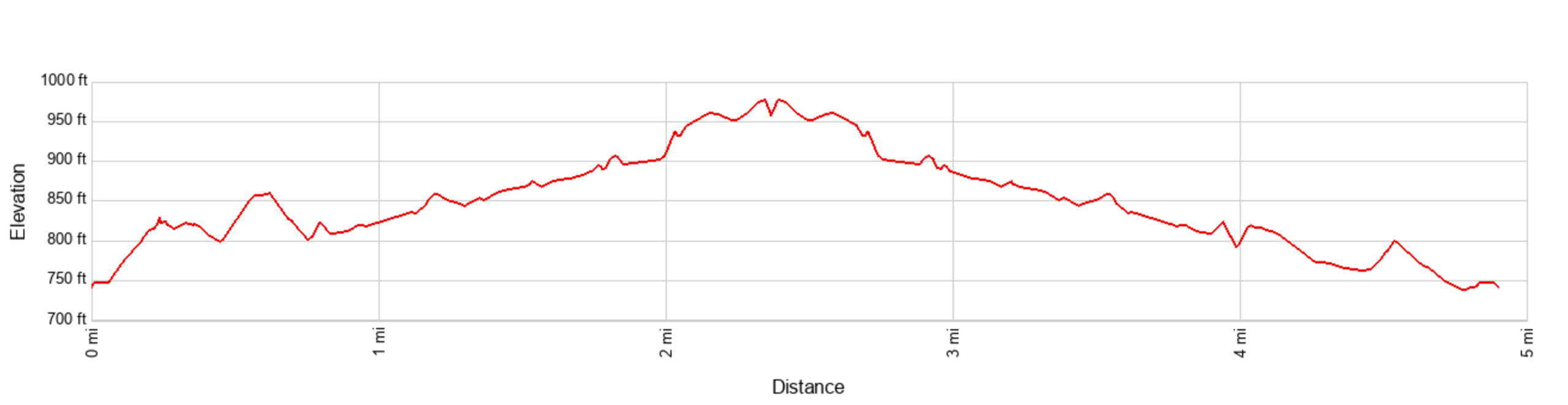
Distance - 7.8 km (about 5 miles). Time - about 2.5 hours.
Accessibility info
Watch the Video
Each Explorer Route has its own video full of info and what you might expect to experience on the walk.
Link to route on Ordnance Survey mapping
You can use the app for free but advanced features are available to subscribers.
Accessibility information
Ascent / Descent - About 500 ft / 150 meters
Facilities
Beside the car park at the start is a café and public toilets (no disabled provision). See the site Access statement for more details.
Terrain and surface
After an initial steep climb along a lane, you follow a farm track and then natural dirt and stone paths through woodland and across moorland to emerge at the remains of Badgworthy village. Sections of the paths can be muddy (particularly in Winter or after heavy rain) and are too narrow and uneven for mobility scooters or rugged pushchairs. The return leg is initially along the same paths, before crossing over a footbridge (steps each side) into Cloud Farm campsite and following the campsite drive back to Malmsmead.
View a more detailed ‘walk-through’ video showing the path surface and terrain along the entire route.
Exmoor Explorers
This is one of our top ten shorter Exmoor walks. We have chosen our favourite walks to help you get a real feel for the wonderful landscape, history and wildlife of Exmoor National Park