
Route Info
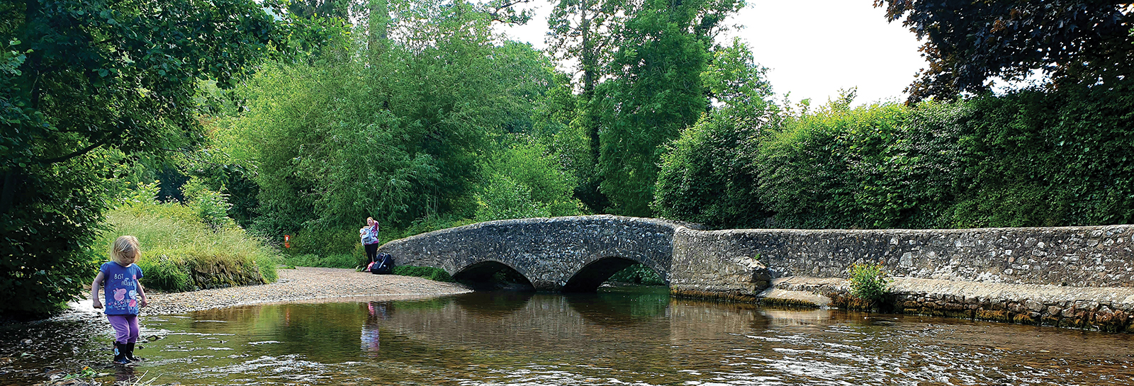
The route starts from Dunster Steep car park next to the Dunster National Park Centre. From here it takes you past the castle and along to Gallox bridge. You then twist your way back through the village passing beautiful and historically interesting buildings. Purchase a water and tear resistant route guide online or from an Exmoor National Park Centre.
Distance - 2.2 km (about a miles) - Time - about 40 mins
Accessibility info
Watch the Video
Each Explorer Route has its own video full of info and what you might expect to experience on the walk.
Link to route on Ordnance Survey mapping
You can use the app for free but advanced features are available to subscribers.
Accessibility information
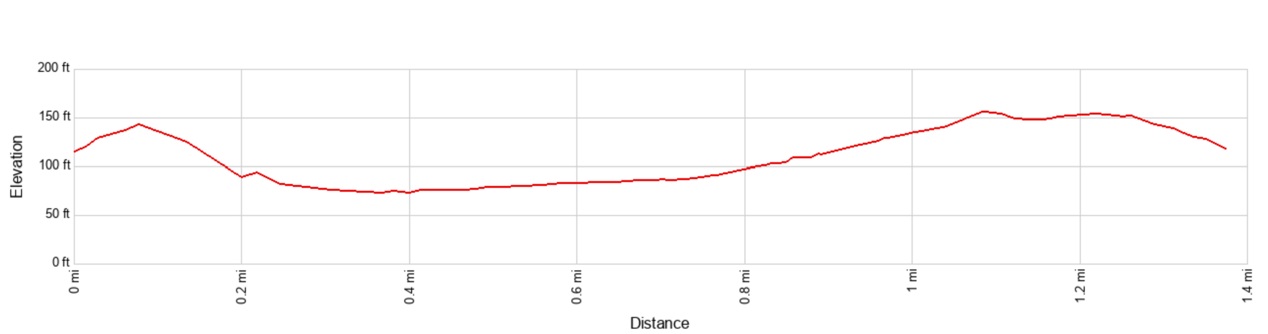
Ascent / Descent - About 100 ft / 30 metres
Facilities
There are public toilets (accessible) in the car park at the start of the walk, and a range of cafes and pubs in the village of Dunster.
Terrain and surface
The most challenging section of this walk is close to the start, where there is a short c.20yd/20 metre climb up a 1:3 slope with exposed tree roots, followed by 80 yards / 75 metre of descent on an earth / grass path down to Dunster Castle car park. The remainder of the route is more level, and is initially across a grass field, before joining a stone surfaced footpath beside the river to Gallox Bridge. The return route through the village is along pavements and tarmacked lanes.
View a more detailed ‘walk-through’ video showing the path surface and terrain along the entire route.
Exmoor Explorers
This is one of our top ten shorter Exmoor walks. We have chosen our favourite walks to help you get a real feel for the wonderful landscape, history and wildlife of Exmoor National Park