
Route Info
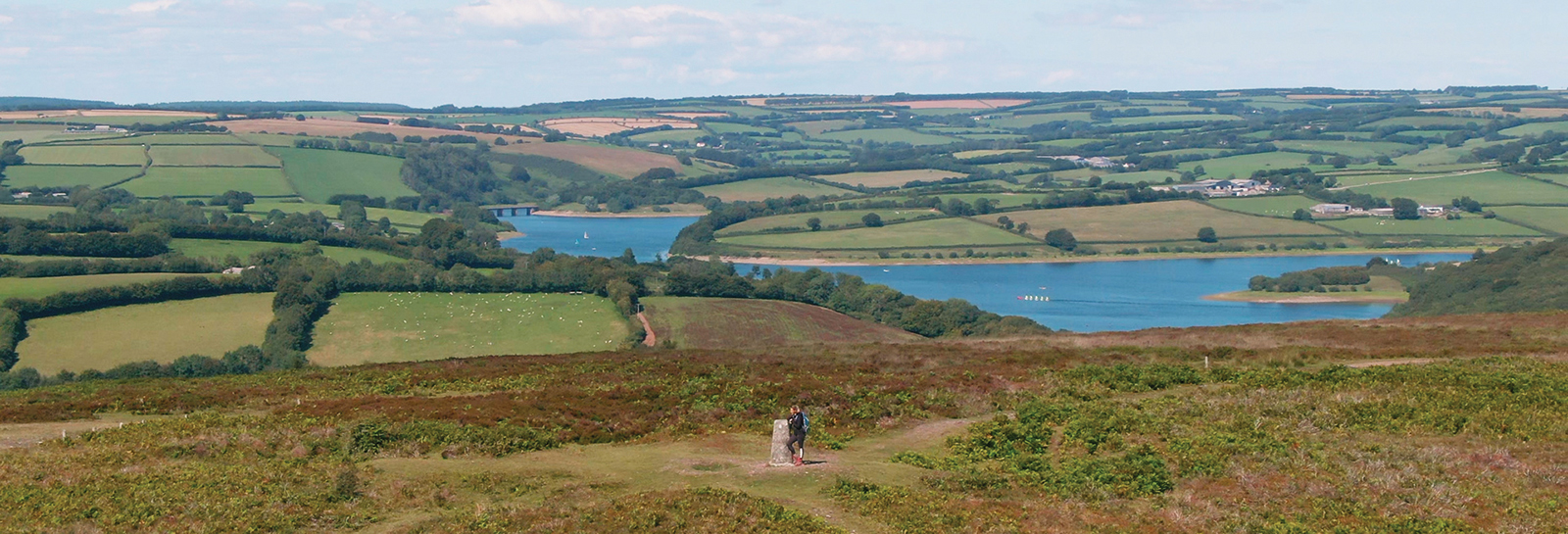
The route starts from Haddon Hill car park. From here you head west up the hill to the trig point (the concrete marker at the top of the hill), from the trig point you head down to the south and then back towards the car park. Purchase a water and tear resistant route guide online or from an Exmoor National Park Centre.
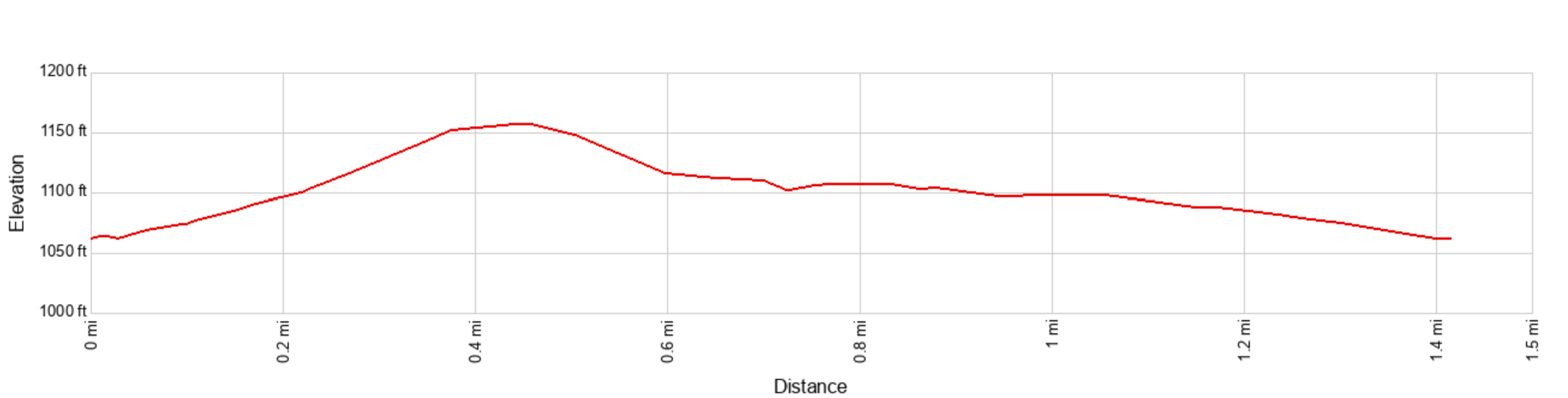
Distance - 2.3 km (about a mile and a half) . Time - about 40 mins
Accessibility info
Watch the Video
Each Explorer Route has its own video full of info and what you might expect to experience on the walk.
Link to route on Ordnance Survey mapping
You can use the app for free but advanced features are available to subscribers.
Accessibility information
Ascent / Descent - About 100 ft / 30 metres
Facilities
In the car park at the start of the walk are accessible public toilets. The nearest refreshments are either at Wimbleball Lake (café) or Dulverton (selection of pubs, cafes and shops).
Terrain and surface
This route is graded under the ‘Miles for Stiles’ as Access For Some: Suitable for sturdy pushchairs, assisted wheelchairs and more robust, all terrain type equipment. Apart from a short optional detour to a trig point, the route follows wide fairly level tracks with a stone / dirt surface. However, these can be muddy or have puddles in places after wet weather.
View a more detailed ‘walk-through’ video showing the path surface and terrain along the entire route.
Exmoor Explorers
This is one of our top ten shorter Exmoor walks. We have chosen our favourite walks to help you get a real feel for the wonderful landscape, history and wildlife of Exmoor National Park